
← All projects
Research
Mapping Paddy Fields, Rice Growth & Irrigation Performance with Sentinel-1 Radar
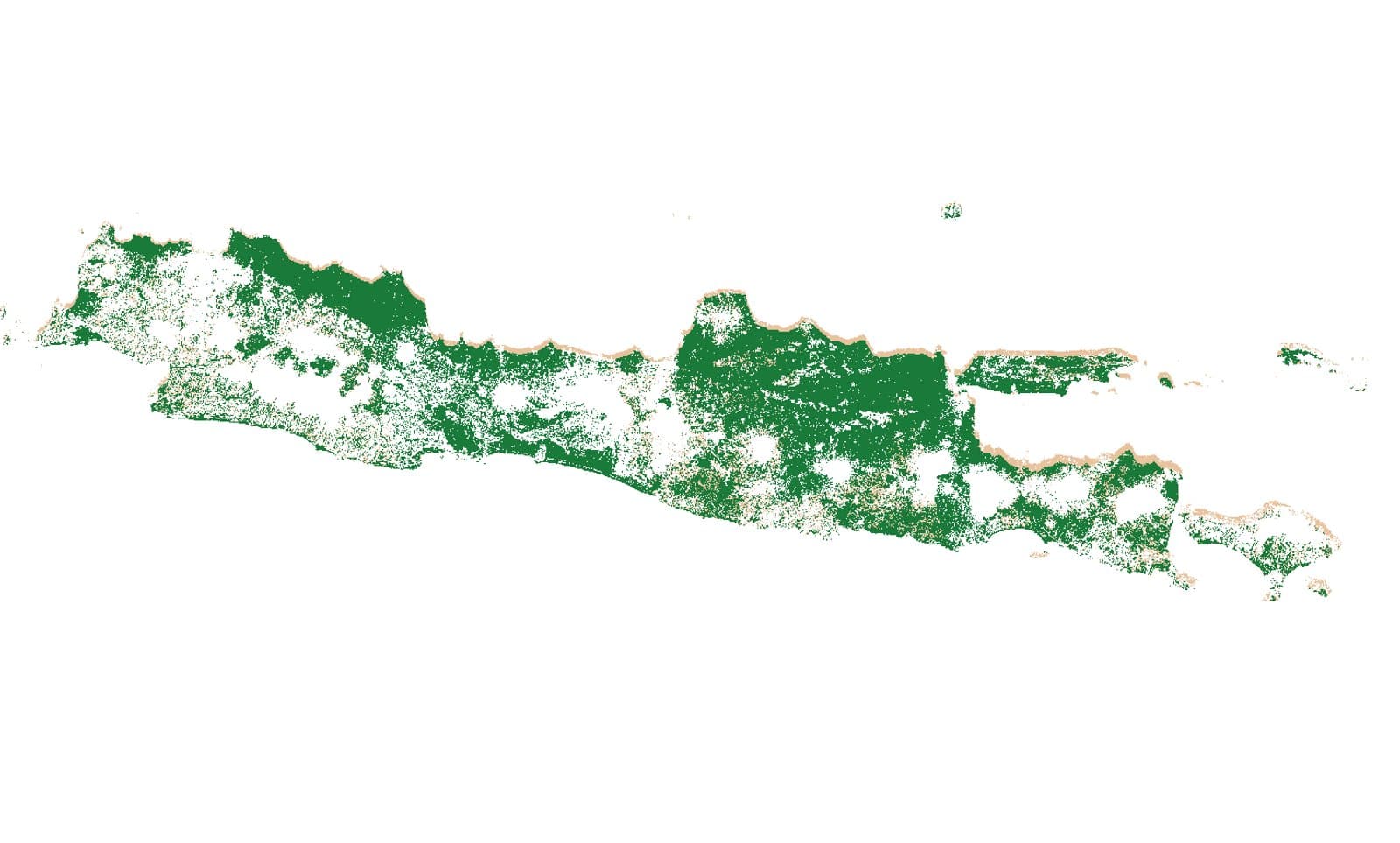
A paddy map of all of Java (~3 million ha), rice growth stages every 12 days, and irrigation performance per tertiary block, all from free, cloud-penetrating Sentinel-1 radar.
- paddy fields mapped
- 3.01M ha
- paddy detection AUC
- 89.6%
- monitoring periods per year
- 31
- tertiary blocks assessed
- 653
The challenge
Java grows much of Indonesia’s rice, but clouds block optical satellites for most of the growing season. Field surveys can’t cover millions of hectares, and irrigation managers need to know whether water actually reaches every block.
Our approach
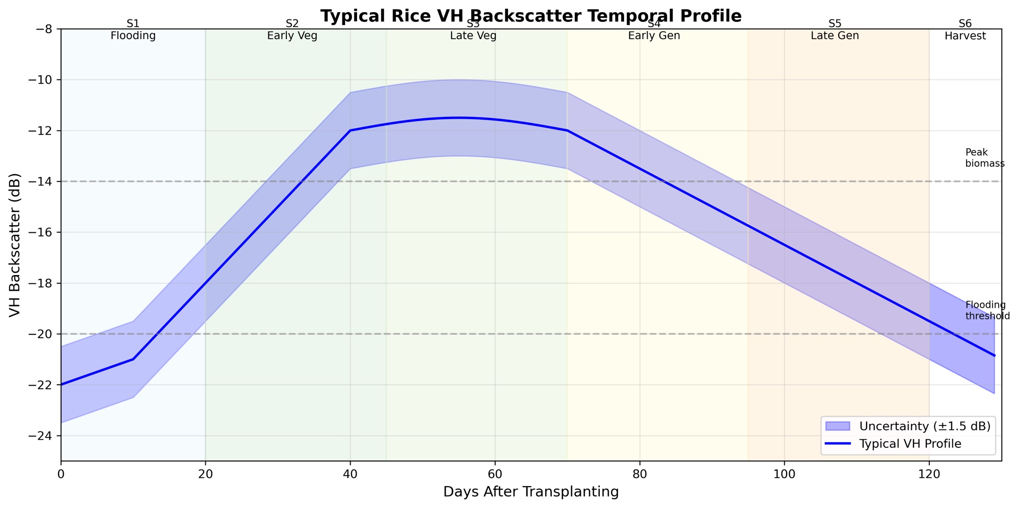
- Radar data: VH time series from ~1,000 Sentinel-1 scenes covering Java. Radar sees through clouds and records rice’s distinctive signature from flooding to harvest.
- Paddy map: phenology features, a neural network with SMOTE class balancing, and a two-year consensus to filter out false detections.
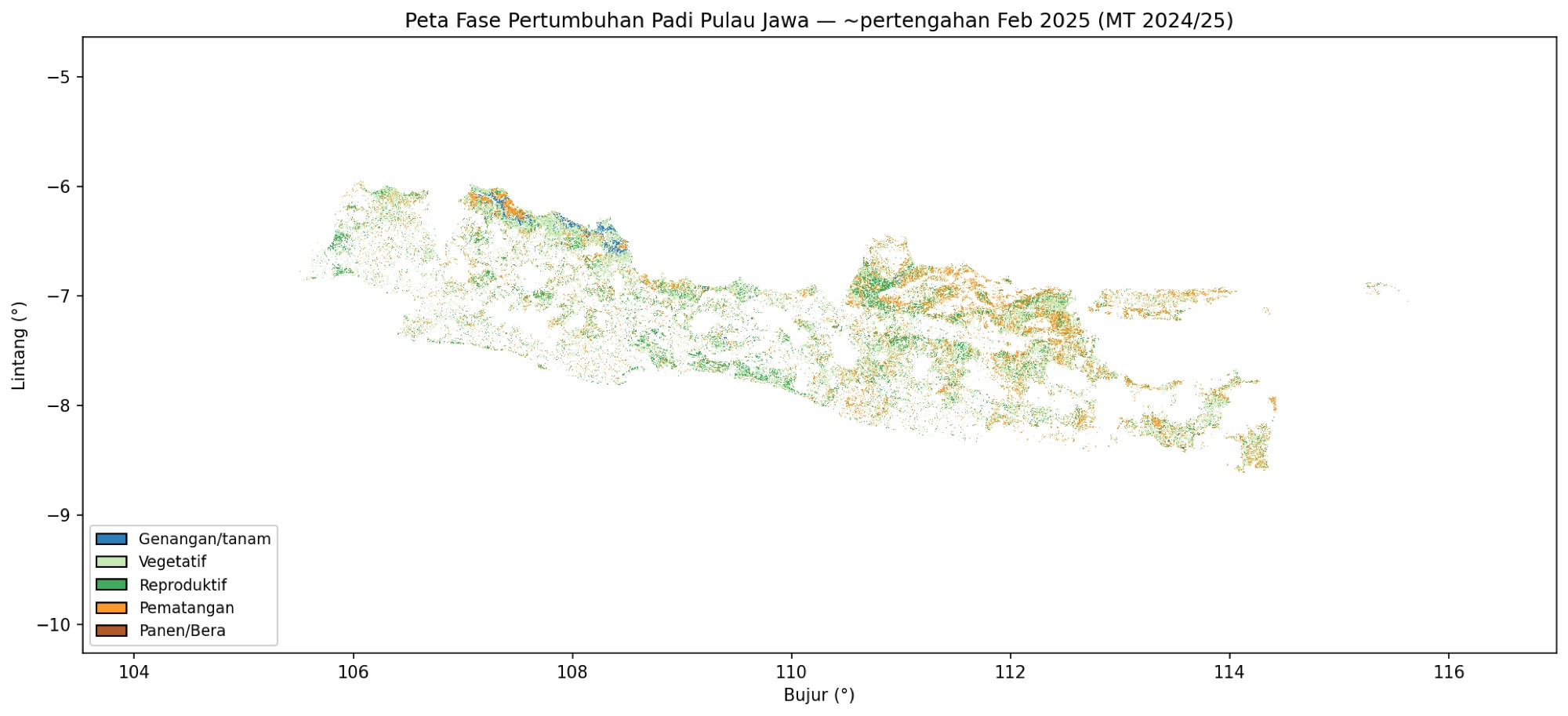
- Growth stage & cropping intensity: time-series models that update each field’s stage every 12-day period and count how many rice cycles it has per year (1×/2×/3×).
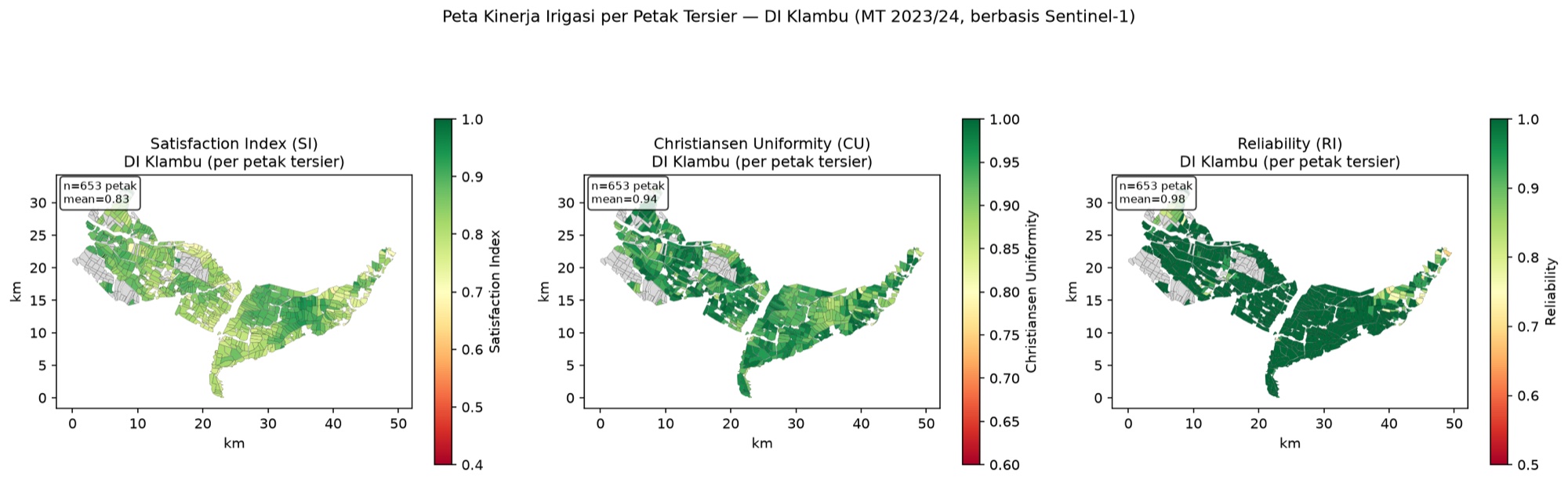
- Irrigation performance: a water balance fusing Sentinel-1, Sentinel-2/Landsat, CHIRPS rainfall and evapotranspiration to compute satisfaction (SI), uniformity (CU) and reliability (RI) per tertiary block.
Results
- A 3.01 million ha consensus paddy map, with 2.28 million ha actively cropped in the 2024/25 season.
- Java-wide rice growth-stage maps updated every 12 days, plus cropping-intensity maps.
- In the DI Klambu irrigation area (2023/24 season), 653 tertiary blocks assessed, averaging SI 0.83, CU 0.94 and RI 0.98.
- The full method is packaged as an open tutorial that runs on a laptop without a GPU.
Photos
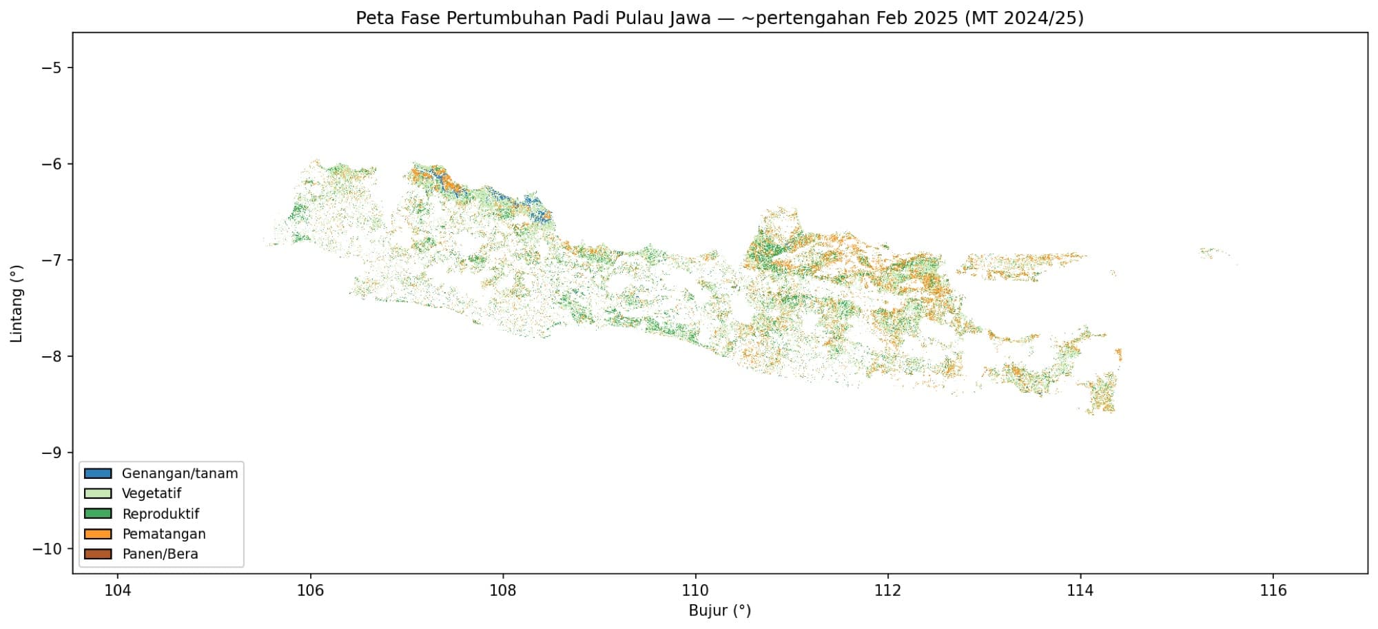
Rice growth-stage map of Java, mid-February 2025 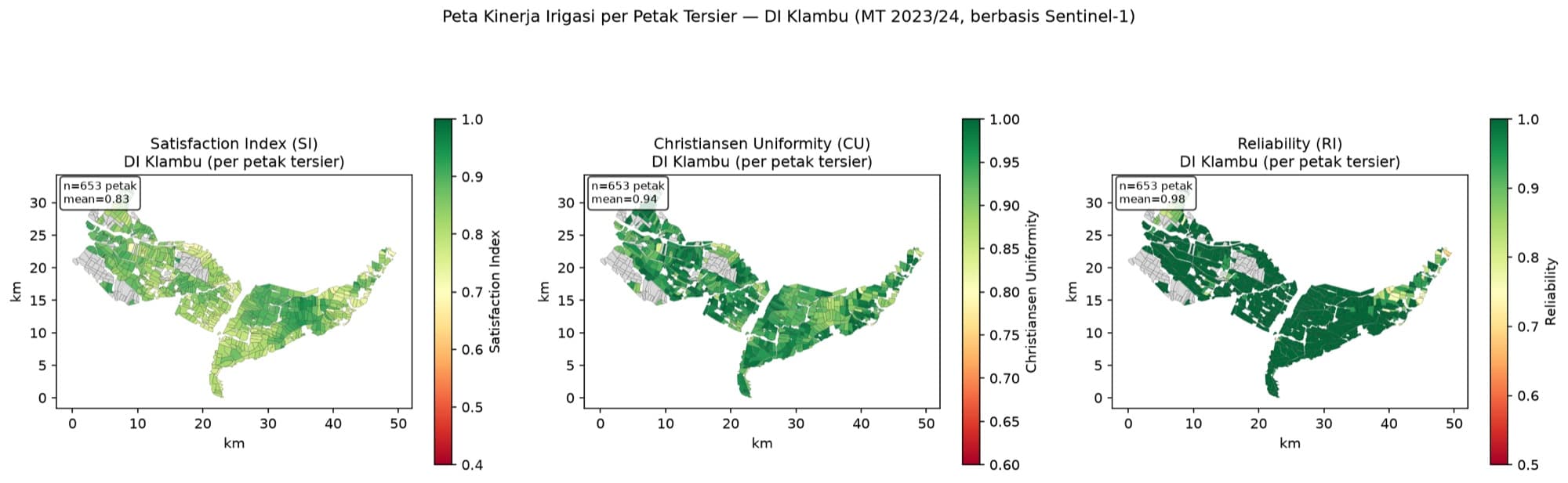
Irrigation performance per tertiary block in DI Klambu: satisfaction (SI), uniformity (CU) and reliability (RI) 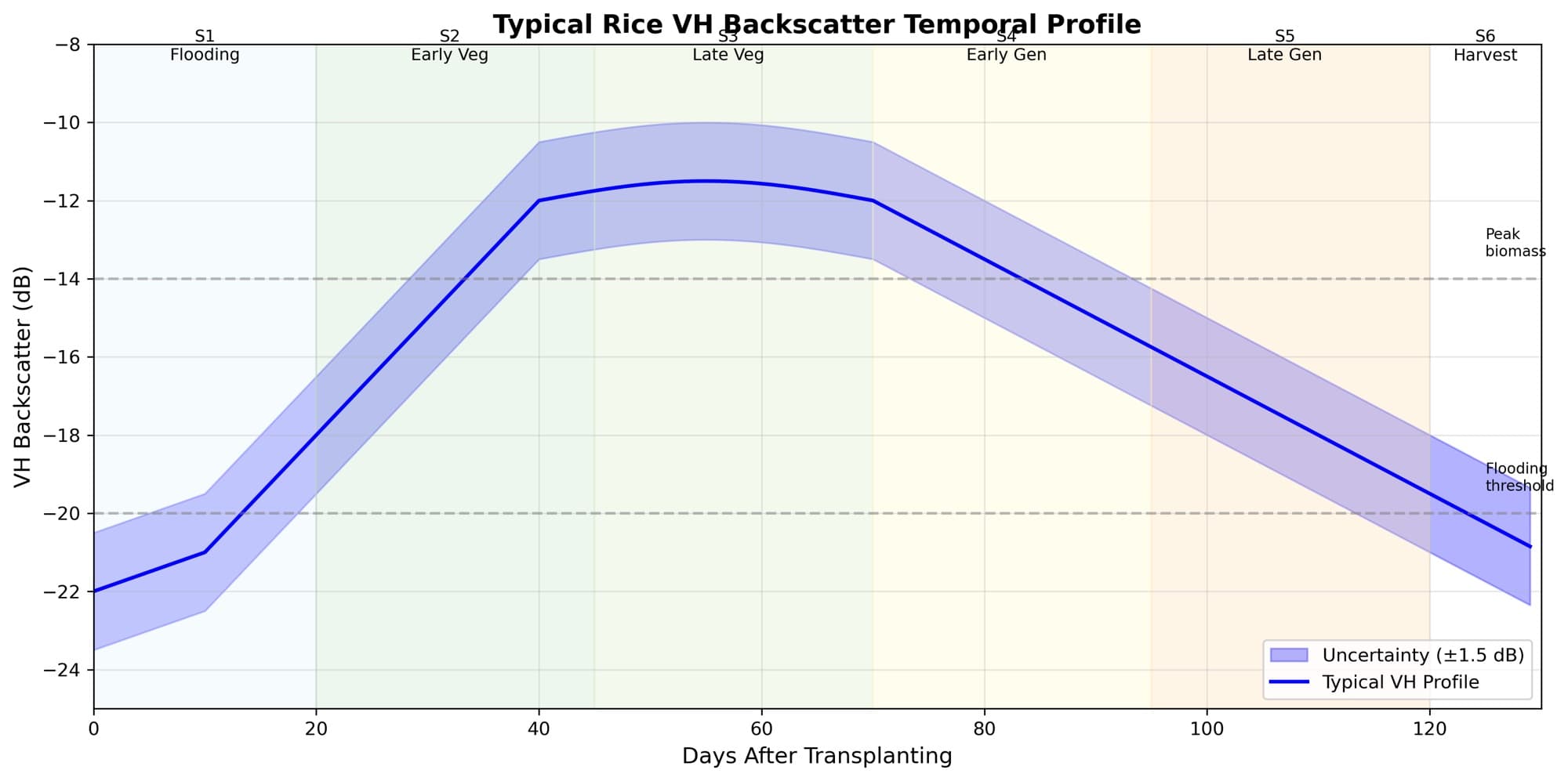
Sentinel-1 VH backscatter profile through the rice growing cycle
Working on something similar?
Tell us what you need — we can help from field survey and analysis through to training your team.