
← All projects
Research
Deep-Learning Super-Resolution of Sentinel-2 Imagery (10 m → 3 m)
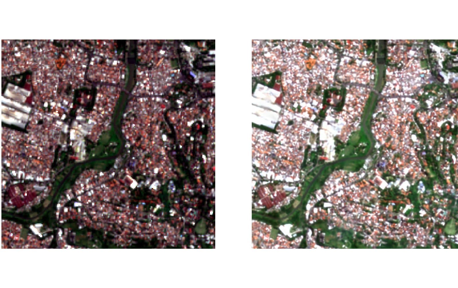
AI models that sharpen free Sentinel-2 imagery (10 m) towards PlanetScope resolution (~3 m), so buildings and paddy plots can be monitored without buying commercial imagery every time.
- image resolution
- 10 → 3.3 m
- building detection F1
- 0.68 → 0.82
- spectral bands sharpened
- 6
The challenge
Indonesia’s Spatial Planning Law (UU 26/2007) calls for monitoring building coverage in more than 500 cities. High-resolution commercial imagery is expensive (US$5–25 per km²), while Sentinel-2 is free but its 10 m pixels are larger than most buildings.
Our approach
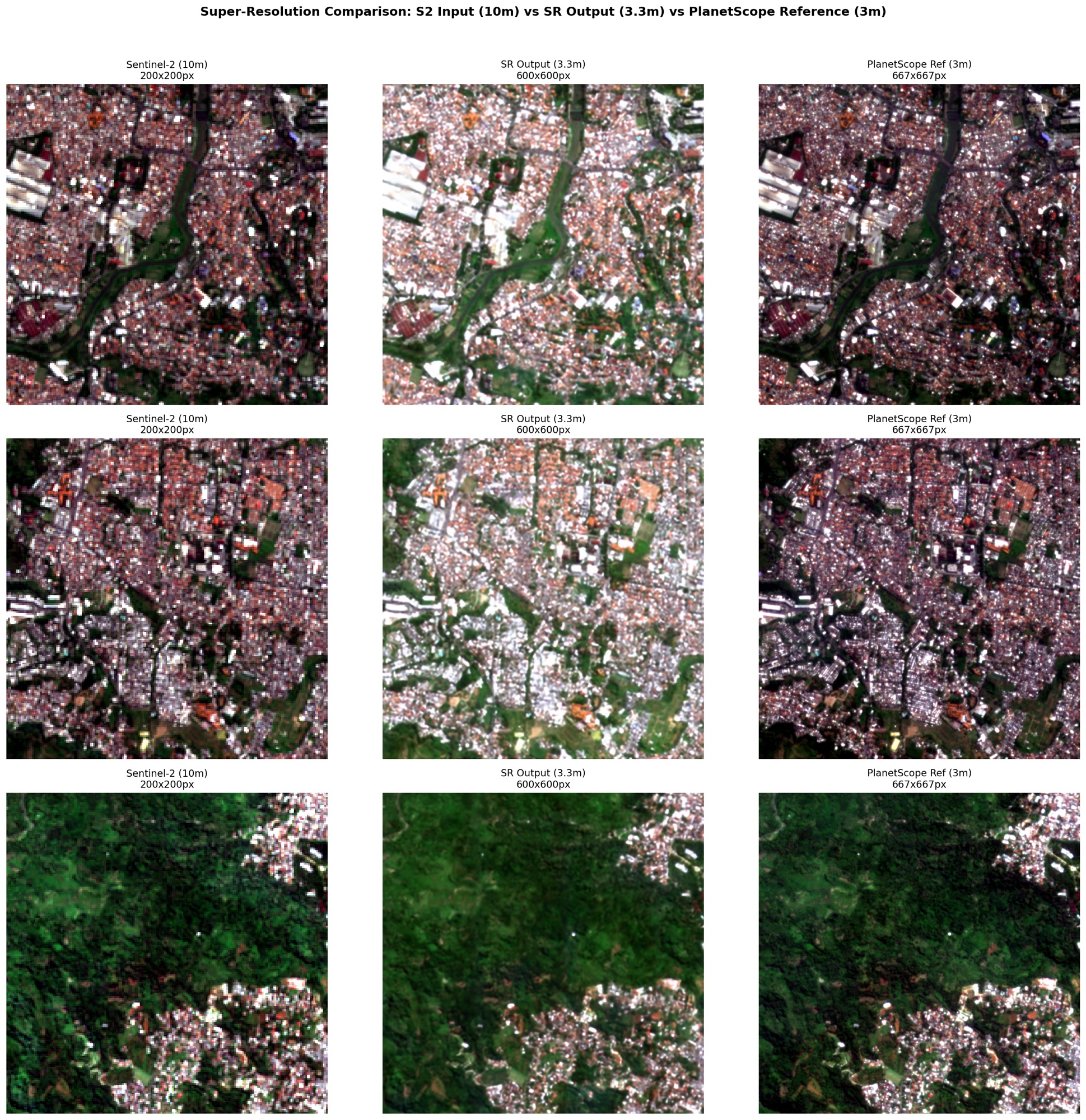
- Paired data: Sentinel-2 (input, 10 m) paired with PlanetScope (target, ~3 m) over the same area, co-registered to sub-pixel accuracy, then cut into 64×64 and 192×192 pixel tile pairs.
- Models: multi-band EDSR and SwinIR architectures for 6 spectral bands, evaluated with PSNR, SSIM, SAM and ERGAS.
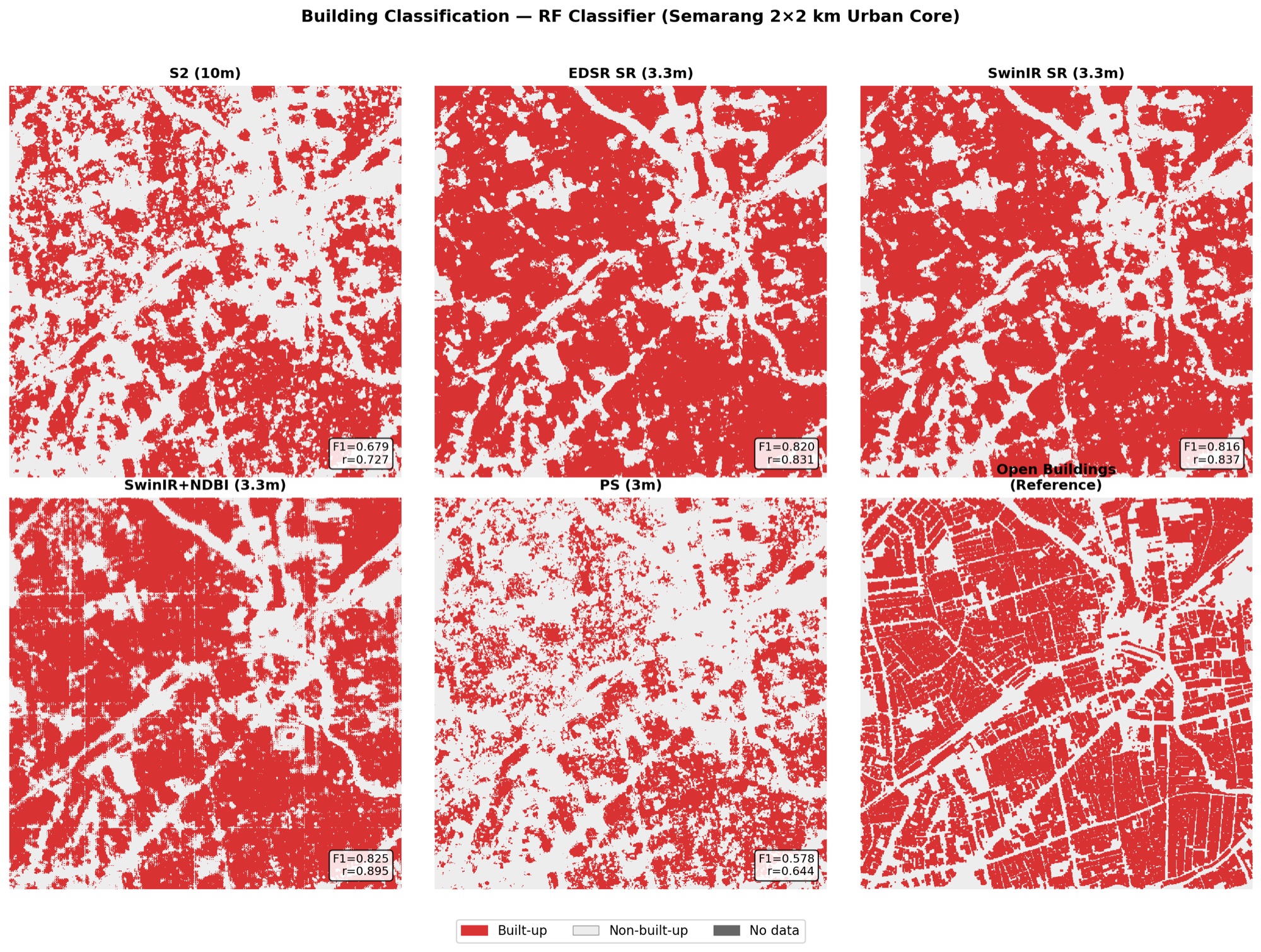
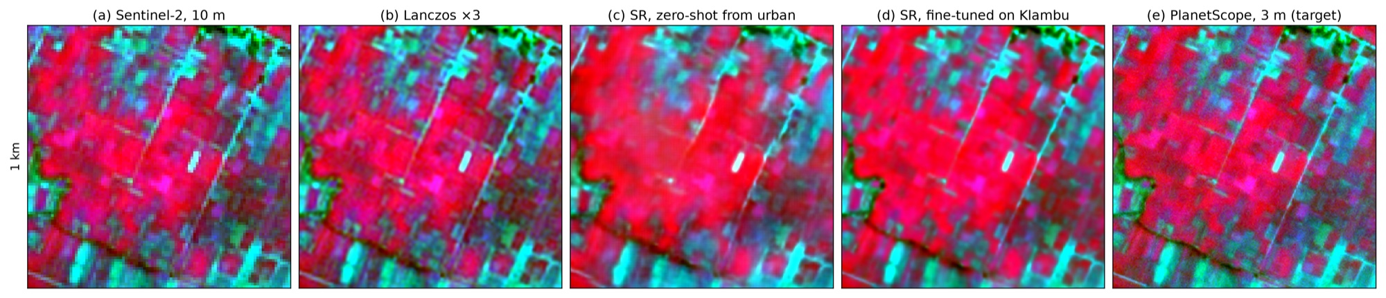
- Real-world tests: building classification in central Semarang, and fine-tuning for paddy plots in DI Klambu.
Results
- In a building-classification test over central Semarang (2×2 km), F1 rose from 0.68 with raw Sentinel-2 to 0.82 with super-resolved imagery.
- Models are city-specific: one trained on Semarang did worse than plain interpolation over parts of Surabaya. A single PlanetScope purchase per city is enough to train a model; after that, free Sentinel-2 does the rest.
- A model fine-tuned for DI Klambu recovers paddy-plot boundaries that the urban model blurs.
Photos
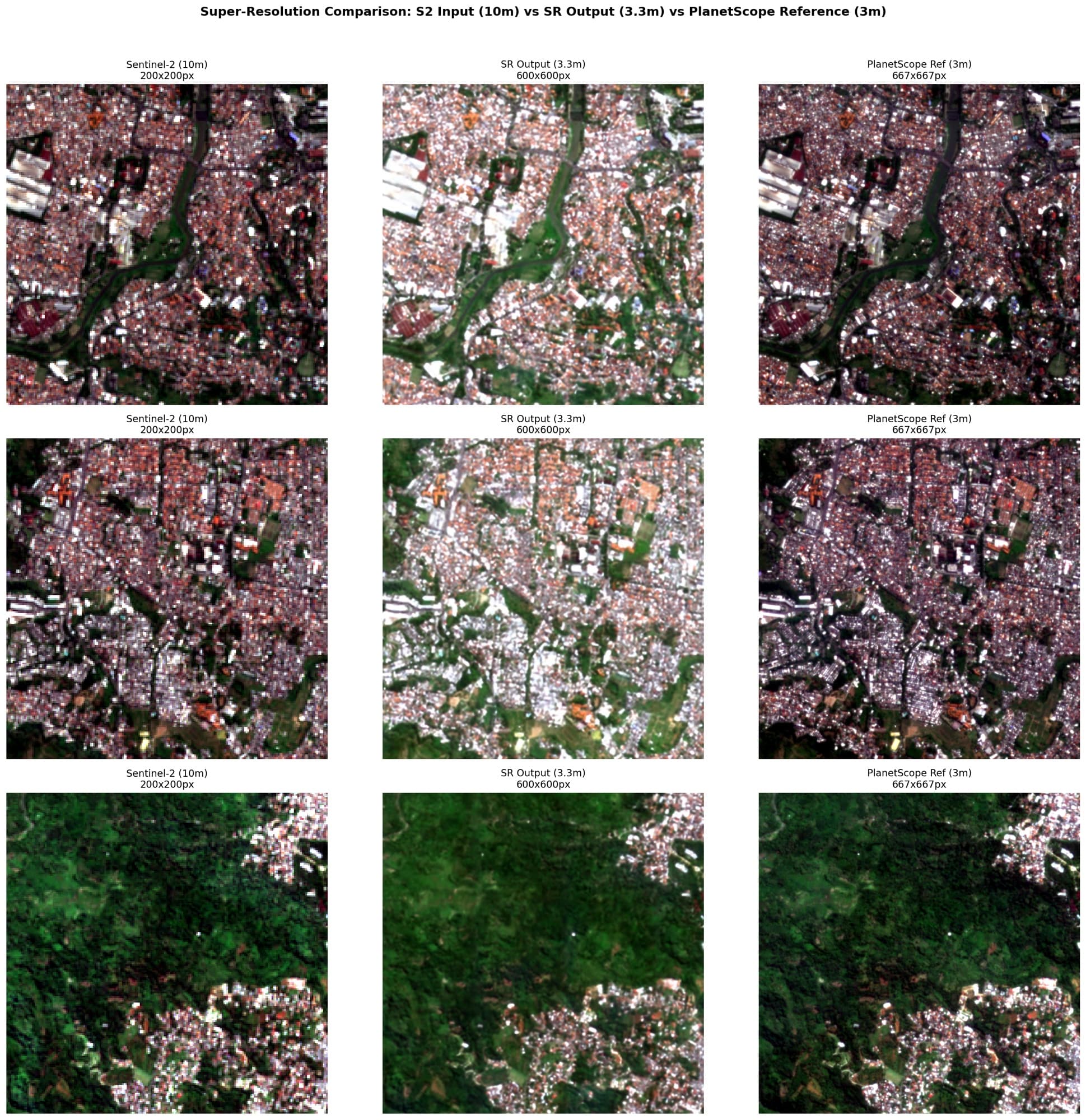
Sentinel-2 (10 m) vs super-resolved output (3.3 m) vs PlanetScope (3 m) 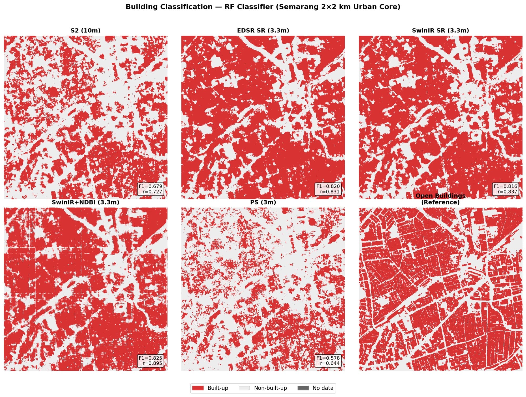
Building classification in central Semarang from raw and super-resolved imagery 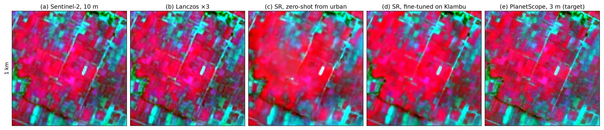
Super-resolution of DI Klambu paddy plots: urban model vs fine-tuned model
Working on something similar?
Tell us what you need — we can help from field survey and analysis through to training your team.